Qualification
Qualification will be held in Noškūnai Forest. Separate qualification races with three heats each for men and women will be organized on this day. Competitors who place in the top 20 will advance to the finals of the long and middle distances.
Distance
From EC to Competition Arena:
- 34 minute drive by car
Parking
Near arena
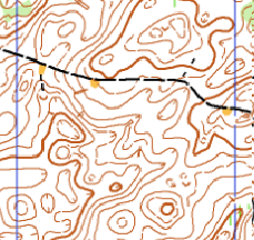
start lists
live gps
results
media
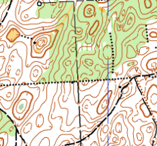
Terrain Info
Noskūnai Forest is a typical Baltic terrain featuring fast runnable forest and rich contour detail. The area is characterized by numerous negative landforms such as depressions and reentrants, providing technical navigational challenges. Vegetation is generally open, allowing for high running speed and good visibility. This classic terrain hosted the Long Distance race of the 2006 Junior World Orienteering Championships (JWOC), demonstrating its suitability for high-level competition.
Terrain Form
Fast
Fast runnable forest with numerous negative contour features
Vegetation
Pine Woods
Coniferous and deciduous forest with dominating pine wood
Paths & Roads
Average Density
Average density forest roads and paths
Speed
Mostly Fast
Mostly good and fast, but limited on dense areas
Visibility
Mostly Good
From very good to limited in dense areas